Sunday, December 8, 2019
I was pretty bored today. The weather wasn’t that great: damp, not warm, damp, gray, and just plain damp. I didn’t feel like heading out to River Song; I didn’t feel like doing much of anything, really.
After spending the morning measuring my dinette and researching recliners–and ordering one–I decided to head out for a few hours while dinner stewed in the crock pot. I consulted my Urban Trail Guide for Olympia and decided to give tiny Burfoot County Park a visit. The guide stated the park has a mile and a half of wooded trails and 1100 feet of Budd Inlet waterfront.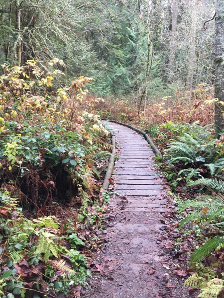
Sounds good to me! Again, this was more a “walk” than a hike. I just needed to spend time outside and get some fresh air.
There were very few vehicles in the parking lot when I got there shortly before 2:00 p.m. I spotted a trail just to the right, leading through a garden of some sort. It seemed like a good starting point. I followed it through the garden and across the road, where I saw a sign for a trail to the beach. Yes! That’s where I wanted to go.
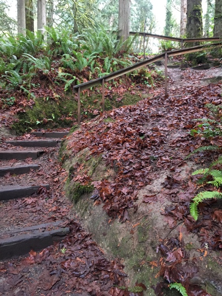
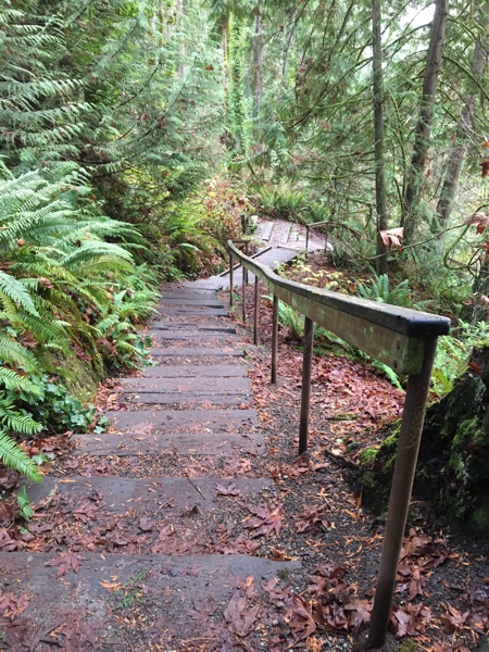
The trail was very well defined, with few roots or other tripping hazards. It led to the edge of a bluff, and then through a series of switchbacks and stepped paths, led down into a ravine. It was pretty steep!
I made my way to the bottom of the ravine, where a small footbridge crossed a stream. Several other trails intersected this one, leading off in opposite directions. More places to explore! For now, however, I chose to keep going straight.
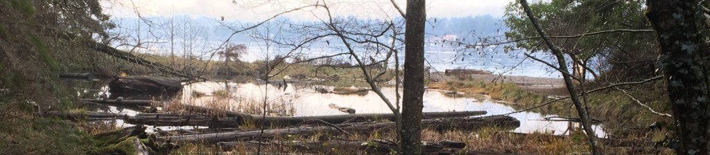
 The trail let to a wood walkway that wound through a small wetland area, around a lagoon, and then to a beautiful, sandy beach along the shore of Budd Inlet. The tide was pretty high, and it looked like a great place for wading or even swimming during the summer. It also has a great view of the Olympic Mountains across the inlet.
A rocky wall blocked the right end of the beach, but I could see the park continued on the other side. I could try to find a trail, or I could climb up the rocks. That was a fun climb! It’s not one that would be difficult for most people, but since my left knee doesn’t bend so well, it was a bit of a fun challenge. And, I managed to haul myself up the rocky embankment and onto the flat, grassy picnic area. A paved path curved its way down into the picnic area. I had read in the guide book that this path led to the Ranger residence at the top of the hill.
There was more beach beyond the picnic area. I followed it to the park boundary, and then made my way back to the paved path and followed it back up to the top of the bluff. It was quite a climb! I was certainly getting a good workout.
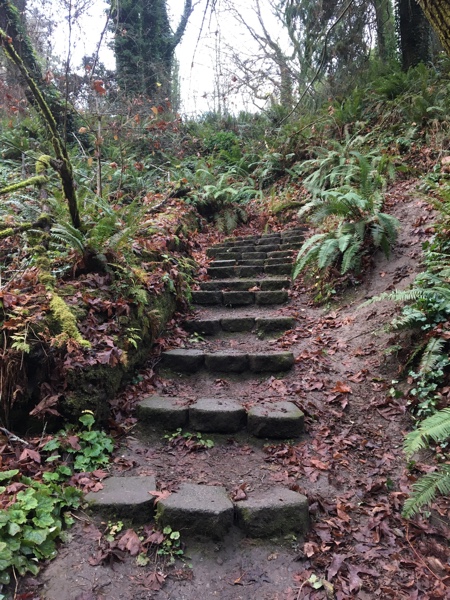
 Just beyond the Ranger residence, I found another trail that led back down into the ravine. I was pretty sure this one came out near the little footbridge I’d seen earlier, and I was right. Again, more switchbacks as I descended into the ravine.
I reached the footbridge and headed back up the trail to the parking. There were slugs on the handrail, so I had to be careful using it to help myself up the steep steps. I did not want to get slimed!
After making it to the top, I decided to explore a new trail and turned to the right instead of to the left back to my truck. I had only walked about a mile and a half and wanted to get more hiking in. The new trail followed the edge of the bluff for a bit, and then back down the other side of the ravine. It had more steps than the other path and fewer switchbacks, but it was equally steep.
I followed it down until it joined up with the other path at the footbridge. I had already explored all the trails down here, so I decided to head back up the bluff. By this time, it was getting late, and although I really hadn’t hiked very far, the trails had been pretty steep, so I was getting a good workout.
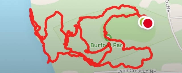
 Back up at the top of the bluff, I continued following the trail around the perimeter of the park and back to my truck. In all, I hiked a total of 2.32 miles in an hour and 17 minutes. According to my phone and MapMyRun, I climbed only a total of 105 feet. However, according to my guidebook, the park has about 300 feet of elevation gain, and that sounds more realistic to me. There was a lot of climbing! And I did cover every trail in the park at least once.
This is a great place for a quick, strenuous hike. If you haven’t got a lot of time and you want to get a good workout, Burfoot Park is perfect. According to my guidebook, the trail difficulty is listed as “easy”–probably because of the relatively short length–but I would put it more on the “moderate” side because it will definitely get your heart pumping!
This is a county park, so no Discover Pass or America The Beautiful pass is needed.
Hilariously, I made a wrong turn and got lost on my way home because my phone died. I ended up circling Fishtrap Loop a couple of times until I figured out to turn right onto Libby Road instead of left. But, it was an interesting drive, and I got an opportunity to explore a new area.