Sunday, January 26, 2020
I signed up for my first snowshoe trip with the Mountaineers! Again, before I signed up, I read the trip description and contacted the trip leader. The six-mile round trip had a difficulty rating of “easy” with a 400-foot elevation gain. I emailed the trip leader and let him know that I am very slow and am unable to keep up with groups. (Honestly, I hate having to do this every time I sign up for a trip with the Mountaineers!) He assured me that the intent was to maintain a pace everyone could manage and keep the group together.
 Only one other person had signed up, so it was just the three of us, including the trip leader. He offered to drive, so we met in the rain at Haggen’s in West Olympia at 7:30 a.m.. Fortunately, we did not have to get up as early as the previous Sunday! Having someone else drive was a nice change, and I got to enjoy the view this time, despite the steady rain.
This trail is a former logging road just below White Pass, near the area where the DOT keeps its snow plows and other road maintenance equipment. Since they have to keep the area plowed, they built in a small Sno Park area for winter sports enthusiasts.
Fortuately, the rain turned to snow a few hundred feet short of the pass. A cold wind greeted us as we climbed out of the car at the Sno Park. It wasn’t very pleasant, even though we were prepared for it. We put on our rain gear and covered our packs before heading out.
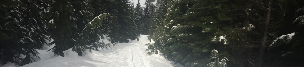
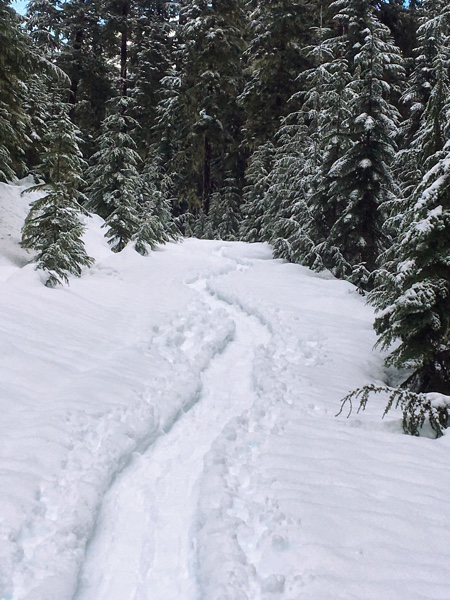
 The trail started up a gentle incline for about the first 2/3 of a mile. And, as soon as we got into the trees, the wind died down. It didn’t take long before we were removing our rain gear.
This was clearly a popular trail as the snowshoe path was well worn. We could tell from the post holes that some people had tried to hike it, as well. Some of the holes were several feet deep, with no sign of ground at the bottom. The snow was obviously very deep.
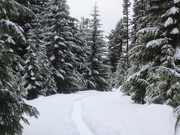
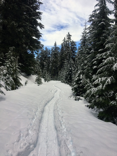
It was a nice, peaceful trip. We had been the first people at the Sno Park, so we had the trail all to ourselves. Since the trail was an old logging road, it was very wide, with no obstructions; very easy to follow and maintain a good pace. However, it followed the slope of the mountain and did go through some avalanche areas. We had reviewed the topographic map from Caltopo, as well as the avalanche report, so we knew where the areas were and the projected danger level. Rain in the past few days had heightened the avalanche danger, but that had come down somewhat for today as the snow level and temperatures dropped a bit.
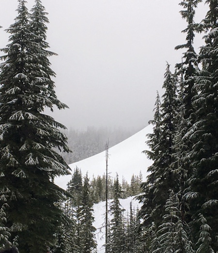
 I practiced my avalanche awareness training when we came to the first area and stopped and observed the steep slope. According to my iPhone, the slope had a 36-degree angle, placing it well within the 30-45 degree avalanche danger zone. Snowballs had rolled down the slope and there were some indications of loose slides, but there were no cracks indicating slab instability.
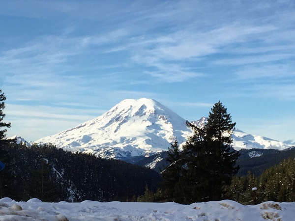
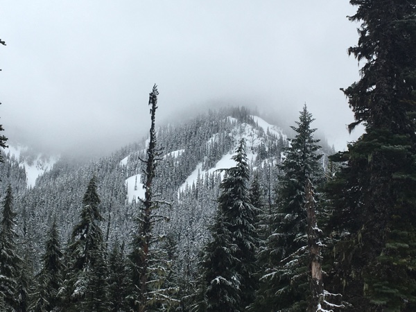
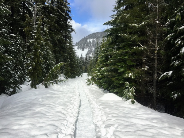
The rest of the trail was fairly level from this point to the end, as it weaved through trees, along the edges of bluffs, and hugged the mountainside. Clouds hid Mount Rainier and most of the surrounding mountains, but we could see Goat Rocks across the valley. Even though much of the view was obscured, it was still pretty spectacular.
 The trail ended at a turnaround spot 2.94 miles from the trailhead, according to my Garmin. We decided to stop and have lunch, but my Garmin made me continue to an even 3.0 miles, so I continued on into the trees while the other two settled down in the snow. Someone else had left tracks here, so clearly, their Garmin wouldn’t allow them to stop, either.
After a brief hike into the trees, my Garmin let me turn around and head back to where the others were seated. It chimed just as I reached them, indicating I’d snowshoed an even three miles. I flattened an area with my snowshoes and dropped my daypack in the snow. I hadn’t brought anything with me to sit on, so I pulled out my daypack rain cover and sat on that. It worked.
After about a half hour, we finished up lunch and headed back. Reluctantly, I led the hike back. I hate being in front because it means I set the pace, which slows everyone else down. However, the other two had taken turns on the way out, so it was my turn now. I set a fast-for-me pace that should be relatively comfortable to maintain, given the flat terrain, and headed back to the trail head.
 We only went about a mile and then ran into people. We weren’t alone anymore! A group of three with two dogs had pulled into the Sno Park as we were heading out. They were not snowshoeing, but rather skiing. We said hi and continued on.
We ran into another group about a hundred yards later, and then another group within a few minutes, and then another. The trail had suddenly become popular! Some had dogs and, at one point, we had to carefully step over a nice, fresh pile IN THE MIDDLE OF THE TRAIL. (Insert annoyed face.)
Before long, and we were back at the Sno Park. Again, my Garmin showed we were just short of three miles, so I walked in the snow along the edge of the road until it said I could stop and then joined the others at the car.
It was a good outing, and I really appreciated being able to snowshoe with others and not end up always falling behind. We were able to stop a couple of times for photographs and take time to enjoy the views. And, we discussed avalanche awareness and tree identification, so the trip was educational, too. I would like to go on more trips like this!
Stats
Trip out: 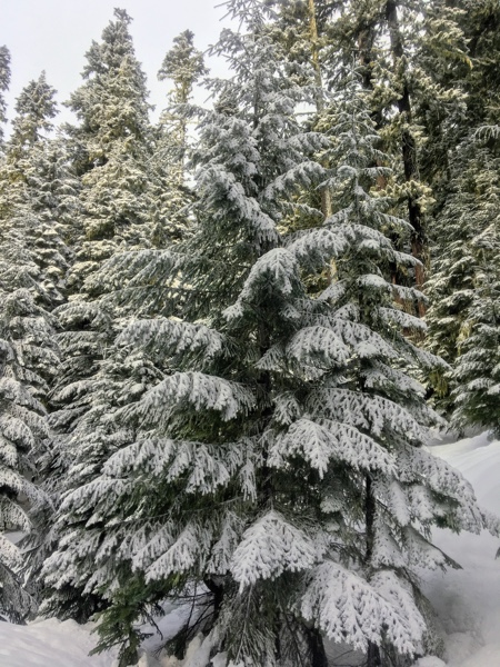
- Distance: 3.0 miles
- Elevation Gain: 532′
- Elapsed Time: 1:53:25
- Moving Time: 1:30:10
- Average Moving Pace: 26:42 (2.2)
- Best Pace: 18:57 (3.2)
Trip back:
- Distance: 3.0 miles
- Elevation Gain: 250′
- Elapsed Time: 1:30:03
- Moving Time: 1:16:22
- Average Moving Pace: 25:27 (2.4 mph)
- Best Pace: 14:09 (4.2 mph)
 Snowshoe weight: 4 pounds, 2 ounces
Daypack weight: approximately 14 pounds. Included ten essentials, lunch, and two liters of water.
Trekking poles weight: 18 ounces
I was pretty exhausted by the time we got back to the car. In fact, I was pretty exhausted by the time we hit that last mile. I was feeling a little shaky, and I felt as if my pace had slowed considerably, but my Garmin doesn’t reflect that. Perhaps I felt I was going at a slower pace because I had become more intentional and focused in my movements.
In any event, the drive home was pretty quiet, at least until we hit I-5. I know I fell asleep a couple of times, and the other passenger may have, as well. I’m glad our driver didn’t!
This was a fun trip! I’d love to do it again, especially in the summer when I can get a closer look at the trees for identification purposes.