Sunday, July 21, 2019
I woke up early Sunday morning to absolutely fabulous weather. Not a cloud in the sky, and not even a hint of wind. Hmmm. It was also high tide.
I knew that because I had checked the tide tables the night before. 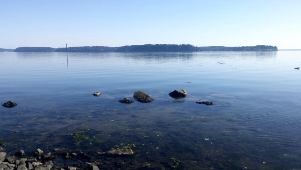
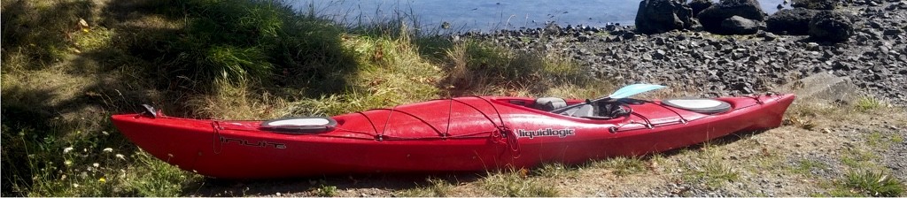
I’ve never kayaked in salt water. I moved here from the Spokane area in March, and all of my kayaking experience has been on lakes, mostly using Dragonfly, my little Pelican Trailblazer 100. Dragonfly was definitely not suited for the Puget Sound, so I would have to use Cool Change, my new-to-me Inuit LiquidLogic 14.5. Did I feel brave enough to head out on the Sound for the very first time in a kayak with tracking issues and missing rudder? Or should I go to church and try to save my soul from eternal damnation? (Just kidding! I’m Unitarian.)
The more I thought about it, the more I heard the Sound calling my name.
That is, after all, why I moved to this area. To spend time kayaking in South Puget Sound.
I didn’t have to go far. I could just kayak around the launch point for a few minutes and see how the Inuit handled in salt water. It would also give me a chance to practice loading and unloading the Inuit from the roof of my Sport Trac. I never unloaded it from Friday, so it was still waiting patiently in the J-cradles. The rest of my gear was in the back, as well. All I had to do was grab a water bottle, and I was good to go.
There were more reasons for going than not, so after a quick bowl of Raisin Bran, I hit the road for the boat launch at the Nisqually Reach Nature Center. 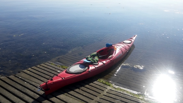 I had worked as part of a Youth Conservation Corp crew at the Nisqually Delta, as it was known then, in the summer of 1977. I spent many weeks building trails along the dike and the wetlands and restoring foot bridges and the two barns. It would be interesting to see how it looks now, especially with the dike gone.
The bay was as still as glass. Sun glinted off the water as seals playfully broke the surface, looking like tiny Loch Ness monsters. A couple of SUP-ers were already out on the water, enjoying the morning.
It was perfect for a first-time sea kayaking experience.
I dropped off Cool Change at the boat launch, parked the Sport Trac, and carried my gear down to the ramp. There is no way I can carry that 65-pound kayak without hurting myself, so I dragged it down the cement ramp and into the water. Frankly, it’s a $400 used kayak. I don’t care if it gets scratched up.
 The cockpit is a lot smaller than Dragonfly’s, and I’m still learning how to get in without tipping over. Thankfully, I managed, and soon was pushing off from the shore.
Cool Change is not nearly as stable as Dragonfly, and I admit–it was a little scary. What if I tip over? I had to keep reassuring myself I could handle it. I’ve taken two classes from REI and have rolled over seven or eight times. Nothing bad happened during any of those rollovers. I would fall out. It’s that simple. And, I’m an excellent swimmer. I can handle it.
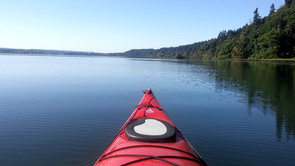
I followed the paddle boarders up the slough and into the estuary formed by McAllister Creek. A long walkway stuck out over the wetlands to my left, with a gazebo at the end for visitors to watch the seals play. Mount Rainier towered over it in the background, making for a great photo shoot. 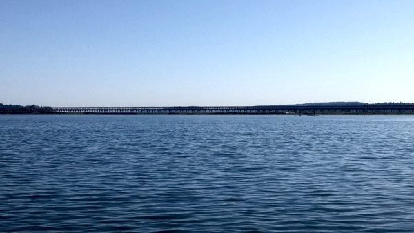 I swung my kayak around for a selfie, hoping the sun wouldn’t cause too much glare.
I headed further up the slough. I don’t remember any of this being here in 1977. It was interesting to see the difference. I also don’t remember seeing all the wildlife. A rocky islet turned out to be seals sunning themselves in the grass. I paddled to the other side of the slough to give them as much space as possible. This is their home; I was an intruder.
I made my way leisurely up the slough until the “No Boats” sign came into view, 1.75 miles from the launch ramp. 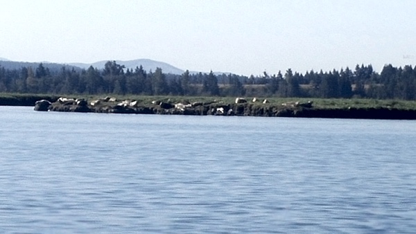 I had been kayaking for about 35 minutes by then, and it occurred to me I could see differences in the tide already. Several more feet of shoreline was already visible, even though the tide was just beginning to turn as I launched. At low tide, the sloughs turned into more than a mile of treacherous mudflats. Anyone caught on them would have to sit it out until high tide. And although I could see I still had several feet of water, I had no idea how fast the tide went out or whether any part of the area behind me might become dry faster than the area in which I was.
Time to get out.
I did a quick 180 and paddled back toward the Sound. 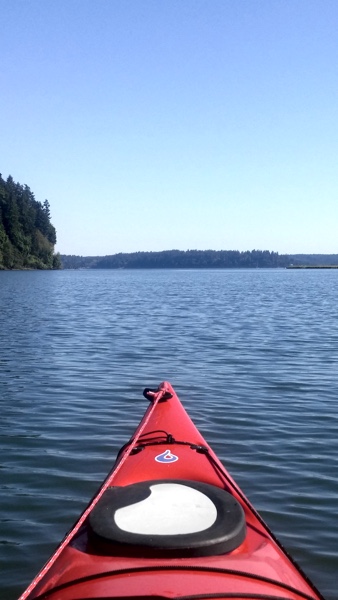 According to my Garmin, my speed increased from about 18 minutes per mile to about 12 minutes per mile as the current helped carry me out. Woohoo! That sets a record for me!
I paddled past the boat ramp for a ways, exploring the beach to the northwest of the wildlife refuge. Tall white buoys or markers of some kind filled the bay. I have no idea what that was about. They seemed to stretch all the way to Anderson Island. There were some larger, black posts, as well, marking a cable crossing. It was really super shallow. A half mile off shore, and it couldn’t have been more than six feet deep, at most.
My Garmin chimed four miles, and I headed back to the boat ramp, knowing I needed to save energy for hoisting Cool Change on top of the Sport Trac. It was a good trip. I’m still getting used to Cool Change, not just the tracking, but also the stability. It will take me a while, but I think it was easier today than my Friday’s outing on Long Lake. I will need a lot more practice getting in and out because my left knee doesn’t bend very well, and that makes it very difficult. 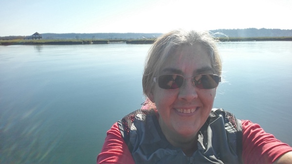 I have to push myself up onto the back of the kayak to get my left leg out, and that always makes the kayak unstable.
Just means I need more practice, right? I need to get out on the Sound more often!